I found a 1914 Topo on the USGS site. The map clearly shows a spur heading almost due north into a complex of buildings. Later maps (mid century) show a much larger mill in the same spot.
That sure looks like the spot Standard. On the attached image, I was standing near the circled red area. Just behind me, the tracks seem like they'd have ran straight into the side of a very steep hill. There's some drainage pipes up the hill. Wondering if this spot had the land area raised after the plaster mill was removed? Unless the tracks skirted just to the east of the hill and continued further north towards Butterworth before becoming level with the land.
Also, I see another spur circled in green. Any idea if that was another mining site?
I'm pretty sure this one has been done before. And yes, that hill was created long after the tracks were gone.
https://www.flickr.com/photos/jimthias/
GRHC - you know every night I can imagine he is in front of his computer screen sitting in his underwear swearing profusely and drinking Blatz beer combing the RailRoadFan website for grammatical errors.
What is known
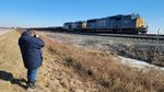
1) out of state, busy location(track layout makes that obvious)
2) control point
3) google street view image
I thought it might be the BNSF Racetrack but like many other commuter lines, industry tracks are almost non-existant.
Since it has been a week, big clue that you need to give some better clues.
Looking north (timetable direction) at the 11th St. crossing in Salisbury, NC on NS's Washington-Atlanta mainline.....behind the photograph is where the line the goes to Asheville splits off
Looking north (timetable direction) at the 11th St. crossing in Salisbury, NC on NS's Washington-Atlanta mainline.....behind the photograph is where the line the goes to Asheville splits off
I was pretty sure you would get this one! However we’re looking south (on the compass and timetable), the junction to the S-Line (or whatever it’s called now) is south of 11th street, not north.
Last edited by David Collins on Mon Nov 14, 2022 1:04 pm, edited 2 times in total.
Looking north (timetable direction) at the 11th St. crossing in Salisbury, NC on NS's Washington-Atlanta mainline.....behind the photograph is where the line the goes to Asheville splits off
I was pretty sure you would get this one! However we’re looking south (on the compass and timetable), the junction to the S-Line (or whatever it’s called now) is south of 11th street, not north.
I've been to this crossing before. Back in 2017, I photographed a few trains a little bit east of here in Yadkin on my drive (for work) from Greensboro to Atlanta. I thought it looked a little familiar.
https://www.flickr.com/photos/jimthias/
GRHC - you know every night I can imagine he is in front of his computer screen sitting in his underwear swearing profusely and drinking Blatz beer combing the RailRoadFan website for grammatical errors.
Also, I see another spur circled in green. Any idea if that was another mining site?
A 3D satellite image of the gypsum mine site. (I toured the mine shafts in 1976)
The building is what was was left of the Grand Rapids Gypsum mill. The mill produced drywall 24/7/365. It lasted as long as it due to its low cost of production. The raw material came from the mine on the other side of the road where the 2-track goes back from Butterworth across the large flat surface.The shaft was at the bottom of the big hill. I took a tour of the site in the 80's/ 4 wheel drive suburban with a big steel protection cage. They gave us ID steel disk to identify us if the roof caved in and flattened us to a blood spot
The area on the riverside that shows removed industrial was the site of the US Gypsum mill. Their raw material came from a shaft on the same side as GR Gyspum. The US Gypsum was a higher cost producer and gone much earlier than GR Gypsum.