Page 461 of 561
Re: Where Is It?
Posted: Thu Dec 31, 2020 8:19 am
by DaveO
Columbus Kansas
Re: Where Is It?
Posted: Thu Dec 31, 2020 12:00 pm
by M.D.Bentley
DaveO nailed it ! Not to tough being there were only 3 ever built. Had to be a maintenance nightmare .
Re: Where Is It?
Posted: Thu Dec 31, 2020 12:56 pm
by ~Z~
Is that triple diamond still in place, as I can't find it on google maps satellite view... unless my vision isn't working right today.
Ok, looking on an old thread from Trainorders, it was removed a while back. Now there's not even a diamond.
https://www.trainorders.com/discussion/ ... ,nodelay=1
Re: Where Is It?
Posted: Thu Dec 31, 2020 1:57 pm
by DaveO
It's still there. In a different location. And slightly neutered.
https://www.google.com/maps/@37.1702595 ... 312!8i6656
Re: Where Is It?
Posted: Thu Dec 31, 2020 2:02 pm
by ~Z~
Definitely neutered. It's just that MD Bentley's photo is from when it was in service from what I see.
Re: Where Is It?
Posted: Thu Dec 31, 2020 2:13 pm
by DaveO
That was what I had to figure out. Was it a current or historic photo. A little research showed it had to be a historic photo.
Re: Where Is It?
Posted: Thu Dec 31, 2020 6:51 pm
by railrod1949
M.D.Bentley wrote: ↑Thu Dec 31, 2020 12:00 pm
DaveO nailed it ! Not to tough being there were only 3 ever built. Had to be a maintenance nightmare .
Yes, indeed it is a three tracks diamond in Columbus in southeast Kansas. Southeast to northwest track was the Katy RR Joplin branch between Parson, KS and Joplin, MO. east to west track was the Frisco Lines trackage between Monett, MO and Ellsworth, KS and the north to south track was another Frisco Lines trackage between Fort Scott, KS and Tulsa, OK.
Re: Where Is It?
Posted: Fri Jan 01, 2021 7:21 am
by ConrailDetroit
Re: Where Is It?
Posted: Fri Jan 01, 2021 7:27 am
by ns8401
Interesting view... gotta love how Google blurred the logo on the caboose.
Re: Where Is It?
Posted: Fri Jan 01, 2021 8:06 am
by AARR
Somewhere on CR Beltline East?
Re: Where Is It?
Posted: Fri Jan 01, 2021 9:02 pm
by M.D.Bentley
The weird thing about this track is that it was just passing through the corner of that building to get to another industry. ( Iam thinking, maybe

)
Re: Where Is It?
Posted: Fri Jan 01, 2021 9:48 pm
by DaveO
M.D.Bentley wrote: ↑Fri Jan 01, 2021 9:02 pm
The weird thing about this track is that it was just passing through the corner of that building to get to another industry. ( Iam thinking, maybe
)
The 1961 aerial shows that track extension serving what appears to be some kind of outdoor storage yard.
I think it possible that yard was related to the business with the track running through it.
For those looking for the the location, that hint in the middle of the picture used with google maps will get you there pretty quickly.
The street used to be named Kosciuszko St but not now

Re: Where Is It?
Posted: Fri Jan 01, 2021 10:22 pm
by GTW6401
I figured it out based on the visible address. I never drive down that particular street.
Re: Where Is It?
Posted: Sat Jan 02, 2021 5:55 am
by DaveO
It's 6421 Cymbal Street in Detroit
I doubt the building over the track was part of the original structure
https://goo.gl/maps/TuXdSGJydrB8KRz9A
I got that it used to be Kosciuszko Street off of the Sanborn Map.
If you only have an address number but know kind of where it should be
Use google maps and zoom into the general area and then input just the address into the search box
Google will give you suggestions to use for the street name
You need to play around sometimes with the zoom level and where you have centered the map
But eventually you will get there
Re: Where Is It?
Posted: Sat Jan 02, 2021 6:38 am
by railrod1949
DaveO wrote: ↑Sat Jan 02, 2021 5:55 am
It's 6421 Cymbal Street in Detroit
I doubt the building over the track was part of the original structure
https://goo.gl/maps/TuXdSGJydrB8KRz9A
I got that it used to be Kosciuszko Street off of the Sanborn Map.
If you only have an address number but know kind of where it should be
Use google maps and zoom into the general area and then input just the address into the search box
Google will give you suggestions to use for the street name
You need to play around sometimes with the zoom level and where you have centered the map
But eventually you will get there
Cymbal Street is in the northeast area of Mt. Elliot Road and I-94 in Detroit, It was off the connection with the CR Terminal West Sub. That building is on the north side of Cymbal Street.
Re: Where Is It?
Posted: Sat Jan 02, 2021 2:15 pm
by ConrailDetroit
Correct
Re: Where Is It?
Posted: Sat Jan 02, 2021 2:55 pm
by Michael
Does anyone know more about these rails over by Shoemaker and St Jean Avenue?
https://goo.gl/maps/P6UJPz9kycTAccAf8
This short spur just crossed St Jean Avenue but I was wondering if there were street car rails running across it.
A 1936 topo maps show the spur and shows that St Jean was in fact a street car line. Maybe Interurban before that.
The Google street view image is from 2011 and the tracks have since been covered over.
Re: Where Is It?
Posted: Sat Jan 02, 2021 3:09 pm
by DaveO
Michael wrote: ↑Sat Jan 02, 2021 2:55 pm
Does anyone know more about these rails over by Shoemaker and St Jean Avenue?
https://goo.gl/maps/P6UJPz9kycTAccAf8
This short spur just crossed St Jean Avenue but I was wondering if there were street car rails running across it.
A 1936 topo maps show the spur and shows that St Jean was in fact a street car line. Maybe Interurban before that.
The Google street view image is from 2011 and the tracks have since been covered over.
The streetview shows the streetcar tracks crossing that spur.
If you weren't aware, Shoemaker was a carhouse.
http://www.detroittransithistory.info/D ... minal.html
The spur would have been for coal deliveries to the heating plant.
It wasn't a powerhouse for the overhead wires.
Re: Where Is It?
Posted: Sun Jan 03, 2021 5:07 pm
by GTW6401
Shoemaker was the main hub for DSR operations. The adminstration building was also there and is still used as the main DDOT bus terminal on the Eastside.
Re: Where Is It?
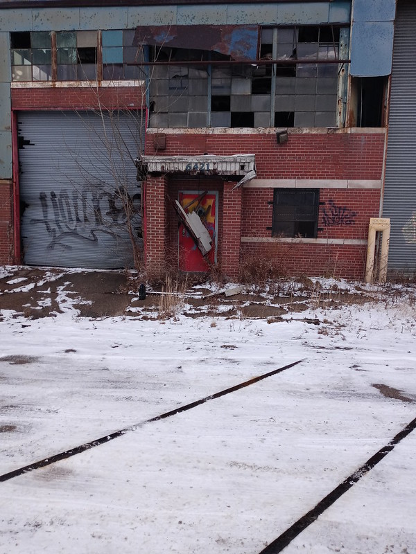
Posted: Tue Jan 12, 2021 2:42 pm
by Michael
Thanks for the info guys.
Anyone know where this was? I believe the photo is from the 70's.