Anybody know where I can find any or all of the old right of way for the old AuSable and Northwestern Railway, later the D&M's AuSable and Northwestern Branch of the D&M? Abandoned during the Depression, the line ran from AuSable to the small (very small) town of Comins with a branch up to Lewiston. This link is all I can find of the AS&NW, and I can't find anything after the D&M got a hold of it.
http://www.michiganrailroads.com/RRHX/R ... W/AS&NW.ht
AuSable and Northwestern Route and Photographs
-
MQT1223
- O Scale Railfanner
- Posts: 4073
- Joined: Wed Sep 10, 2014 1:46 pm
- Location: Grandville, Michigan
- Contact:
AuSable and Northwestern Route and Photographs
1223 OUT! President and Founder of the Buck Creek Central, the Rolling River Route! (2012-2017) President and Founder of the Lamberton Valley Railroad, The Tin Plate Road! Proudly railfanning with Asperger's since 1996. 
-
MP73point4
- Railroadfan...fan
- Posts: 257
- Joined: Tue Sep 07, 2010 12:24 pm
- Location: Billtown, MI
Re: AuSable and Northwestern Route and Photographs
You really need to save your money and buy a copy of the SPV railroad atlas that covers Michigan (Great Lakes East). It contains the answer to your question. Another good resource for questions of this level of detail is Graydon Meints' book Michigan Railroad Lines. It's two volumes and expensive, but has line by line histories of every railroad in Michigan. Christmas is coming, maybe a birthday....
RR Pass Collector
-
MQT1223
- O Scale Railfanner
- Posts: 4073
- Joined: Wed Sep 10, 2014 1:46 pm
- Location: Grandville, Michigan
- Contact:
Re: AuSable and Northwestern Route and Photographs
What exactly are the books called? My birthday is already gone by but not Christmas obviously. Do you have those books to share info on this line right now? I would also like to know where I can find remnants of this line today.MP73point4 wrote:You really need to save your money and buy a copy of the SPV railroad atlas that covers Michigan (Great Lakes East). It contains the answer to your question. Another good resource for questions of this level of detail is Graydon Meints' book Michigan Railroad Lines. It's two volumes and expensive, but has line by line histories of every railroad in Michigan. Christmas is coming, maybe a birthday....
1223 OUT! President and Founder of the Buck Creek Central, the Rolling River Route! (2012-2017) President and Founder of the Lamberton Valley Railroad, The Tin Plate Road! Proudly railfanning with Asperger's since 1996.
-
MP73point4
- Railroadfan...fan
- Posts: 257
- Joined: Tue Sep 07, 2010 12:24 pm
- Location: Billtown, MI
Re: AuSable and Northwestern Route and Photographs
The books are the two volume "Michigan Railroad Lines" by Graydon Meints; and "SPV's Railroad Atlas of North America - Great Lakes East". They are available on Amazon for $100 and $30 - plus shipping, respectively. Go there and look them both up and you'll get an idea what's in them.
Another good historical reference book is "Michigan Railroads & Railroad Companies" also by Graydon Meints. It just doesn't cover the specifics of what you're asking about. Neither book is really interesting reading, but they are chocked full of historical information if you're doing research. Meints is the resident expert on Michigan railroads. You can't go wrong adding any of his work to your library.
Both of Meints books are published by the Michigan State University Press. I purchased mine there when they were on sale for a bit less than the Amazon prices, but who knows when they might be on sale there.
Yes, I have both and will add some stuff from them after I get home from work and can do some scanning.
I don't know where you can find remnants of the A&NW today. It's been gone a long time. The research material will tell you where to look on Bing Maps, Google Earth, or by shoe leather express.
RR Pass Collector
-
Standard Railfan

- Railroadfan...fan
- Posts: 1804
- Joined: Wed Jan 18, 2012 7:25 pm
- Location: Marquette, MI
Re: AuSable and Northwestern Route and Photographs
You may want to check your local library. I seem to find Meints' books in many Michigan libraries.
-
MP73point4
- Railroadfan...fan
- Posts: 257
- Joined: Tue Sep 07, 2010 12:24 pm
- Location: Billtown, MI
Re: AuSable and Northwestern Route and Photographs
I probably shouldn't be posting copywritten material on here. PM me with your email and I'll see what I can do.
RR Pass Collector
-
SW
- Rail Trail Explorer
- Posts: 11082
- Joined: Tue Jul 05, 2005 10:51 pm
- Location: Owosso, MI - 1 mile north of the GLC
Re: AuSable and Northwestern Route and Photographs
There is a set of 3 books written around 1970 on Michigan Ghost Towns by Roy L. Dodge. The Lower Peninsula towns are in Vol. 1 & 2. Looks like Amazon is selling a combined version of those volumes: http://www.amazon.com/Michigan-Ghost-To ... host+towns
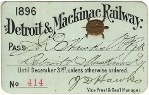
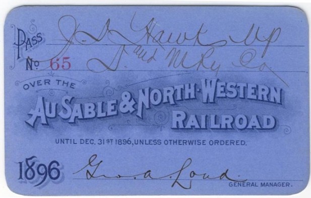
The chapters on Iosco Co. (vol. 1) and Oscoda Co. (vol. 2) contain some information about Comins, AuSable, Bamfield, and other towns along the AS&NW and railroad operations.
The chapters on Iosco Co. (vol. 1) and Oscoda Co. (vol. 2) contain some information about Comins, AuSable, Bamfield, and other towns along the AS&NW and railroad operations.
Owosso Steve
-
wagnew0923
- Railroadfan...fan
- Posts: 416
- Joined: Sun Jun 10, 2012 10:37 am
Re: AuSable and Northwestern Route and Photographs
Or you can use the Michigan Topographical maps and compare them to the maps on michiganrailroads.com. It also does not hurt to look at Bing maps.
-
MQT1223
- O Scale Railfanner
- Posts: 4073
- Joined: Wed Sep 10, 2014 1:46 pm
- Location: Grandville, Michigan
- Contact:
Re: AuSable and Northwestern Route and Photographs
The thing is I can't find any evidence on Bing Maps or Google Maps where I could START to follow the old line. Plus the AS&NW route is not shown in a lot of detail. It shows the general path but I can't look at a satellite image.wagnew0923 wrote:Or you can use the Michigan Topographical maps and compare them to the maps on michiganrailroads.com. It also does not hurt to look at Bing maps.
1223 OUT! President and Founder of the Buck Creek Central, the Rolling River Route! (2012-2017) President and Founder of the Lamberton Valley Railroad, The Tin Plate Road! Proudly railfanning with Asperger's since 1996.
-
Dan Cluley
- Railroadfan...fan
- Posts: 2645
- Joined: Mon Feb 26, 2007 6:58 am
- Location: Lansing
Re: AuSable and Northwestern Route and Photographs
Resurrecting this old thread, though it appears I'm six years too late.
I joined this forum and pm-ed the OP about two months ago with the idea of offering help in his desire to hike the old AuSable and Northwestern route. Possibly others have the same interest as MQT in this long-abandoned logging road that connected Oscoda/AuSable with McKinley and points north..
This past summer I got the bug myself to see what I could find of the old ASNW roadbed. You might say I've gotten carried away, but it's been fun. I enjoy maps and trekking the wilds so this has been right up my alley.
It's been very slow going, piecing together old maps, new maps and beating the countryside on foot. With compass, map and much shoe leather, I've made good headway but I don'[t know if I'll live long enough to complete the job.
If anyone has interest in this road and a career in the Woods Detective business, I might be able to help.
Just found your pm MQT. Will respond.