Help Hiking Advice Needed
-
wagnew0923
- Railroadfan...fan
- Posts: 416
- Joined: Sun Jun 10, 2012 10:37 am
Help Hiking Advice Needed
I am planning a January Southeast Michigan (Port Huron, Durand, Ann Arbor, Detroit area) hike. I need an abandoned rail line that has not been all made over and can still have some awesome artifacts on it, has nice scenery in January, and is not to rugged. I was thinking the Wahdam to Avaco trail but not so heavily explored. Any ideas.
-
wagnew0923
- Railroadfan...fan
- Posts: 416
- Joined: Sun Jun 10, 2012 10:37 am
Re: Help Hiking Advice Needed
Sorry, as far west as Lansing
Re: Help Hiking Advice Needed
A group of us went along the old PM from Port Huron to Croswell. I don't recall the exact location, GLRF might, there is an old man-made above ground pond complete with pump system where they used to water steam engines and hasn't been used in over 60 years but it's still there.
PatC created a monster, 'cause nobody wants to see Don Simon no more they want AARR I'm chopped liver, well if you want AARR this is what I'll give ya, bad humor mixed with irrelevant info that'll make you roll your eyes quicker than a ~Z~ banhammer...
-
wagnew0923
- Railroadfan...fan
- Posts: 416
- Joined: Sun Jun 10, 2012 10:37 am
Re: Help Hiking Advice Needed
I think I found the trail. It looks to me like there is an intact spur between Avaco and Yale. but it does not connect to anything active. It think this is where your man made pond is.
Re: Help Hiking Advice Needed
No, it's on the old ROW between Port Huron and Croswell. Between Avaco and Yale is the former Port Huron Sub. However, there is a respectable bridge just east of Avoca.
wagnew0923 wrote:I think I found the trail. It looks to me like there is an intact spur between Avaco and Yale. but it does not connect to anything active. It think this is where your man made pond is.
PatC created a monster, 'cause nobody wants to see Don Simon no more they want AARR I'm chopped liver, well if you want AARR this is what I'll give ya, bad humor mixed with irrelevant info that'll make you roll your eyes quicker than a ~Z~ banhammer...

Re: Help Hiking Advice Needed
Only thing east of Lansing is the old line that ran to Owosso. You won't be hiking along that unless you want to get arrested and/or shot at.wagnew0923 wrote:Sorry, as far west as Lansing
https://www.flickr.com/photos/jimthias/
GRHC - you know every night I can imagine he is in front of his computer screen sitting in his underwear swearing profusely and drinking Blatz beer combing the RailRoadFan website for grammatical errors.
GRHC - you know every night I can imagine he is in front of his computer screen sitting in his underwear swearing profusely and drinking Blatz beer combing the RailRoadFan website for grammatical errors.
-
wagnew0923
- Railroadfan...fan
- Posts: 416
- Joined: Sun Jun 10, 2012 10:37 am
Re: Help Hiking Advice Needed
AARR I am having trouble identifying the line to Croswell near Port Huron. Is there a town near Port Huron where it went through.
Re: Help Hiking Advice Needed
The only major community it went through was Jeddo. Maybe someone else can help with this on.
wagnew0923 wrote:AARR I am having trouble identifying the line to Croswell near Port Huron. Is there a town near Port Huron where it went through.
PatC created a monster, 'cause nobody wants to see Don Simon no more they want AARR I'm chopped liver, well if you want AARR this is what I'll give ya, bad humor mixed with irrelevant info that'll make you roll your eyes quicker than a ~Z~ banhammer...
-
Michael
- Railroadfan...fan
- Posts: 11023
- Joined: Sun Sep 12, 2010 2:52 pm
- Location: Plymouth, Michigan
Re: Help Hiking Advice Needed
I did not confirm this with old topo maps but tracing the ROW seem pretty straightforward using Google Maps and back tracking from Croswell where the line currently starts/ends.AARR wrote:The only major community it went through was Jeddo. Maybe someone else can help with this on.wagnew0923 wrote:AARR I am having trouble identifying the line to Croswell near Port Huron. Is there a town near Port Huron where it went through.
Right at the intersection of M-90 & Croswell Road the ROW goes straight south almost 4 miles just on the west side of Croswell Road to Gardner Line Rd where is jogs a bit to the east continuing south to about 1/2 mile west of downtown Jeddo
Much of the line looks like it is now used for utilities.
-
wagnew0923
- Railroadfan...fan
- Posts: 416
- Joined: Sun Jun 10, 2012 10:37 am
Re: Help Hiking Advice Needed
Ok I got it. It looks like south of Croswell another line crossed this line going Northwest/southeast.
-
Michael
- Railroadfan...fan
- Posts: 11023
- Joined: Sun Sep 12, 2010 2:52 pm
- Location: Plymouth, Michigan
Re: Help Hiking Advice Needed
No. That is just a transmission line you are looking at.wagnew0923 wrote:Ok I got it. It looks like south of Croswell another line crossed this line going Northwest/southeast.

.........................

-
GreatLakesRailfan
- Railroadfan...fan
- Posts: 4829
- Joined: Wed Aug 24, 2005 12:28 am
- Location: Marysville, Michigan
Re: Help Hiking Advice Needed
AARR, I think you're talking about the Atkins area.
The area in question is part of the Port Huron State Game Area. I'd make sure to wear lots of orange, if you're heading into that area, wagnew0923. It's an interesting area to hike in, and has several abandoned logging(?) roads you can walk on as well.
Using Google's maps, I think this is near the location AARR mentioned.
Clyde Township, MI
43.064712, -82.586743
The tree coverage is pretty thick. We had to hike in from the parking lot at the end of Feick Road, but all I recall is that we had a local guide (who posts here occasionally) and we didn't take the Feick Road right of way leading southwest from the parking lot.
Clyde Township, MI
43.064485, -82.581387
For what it's worth, this is one of the artifacts we found in the woods:
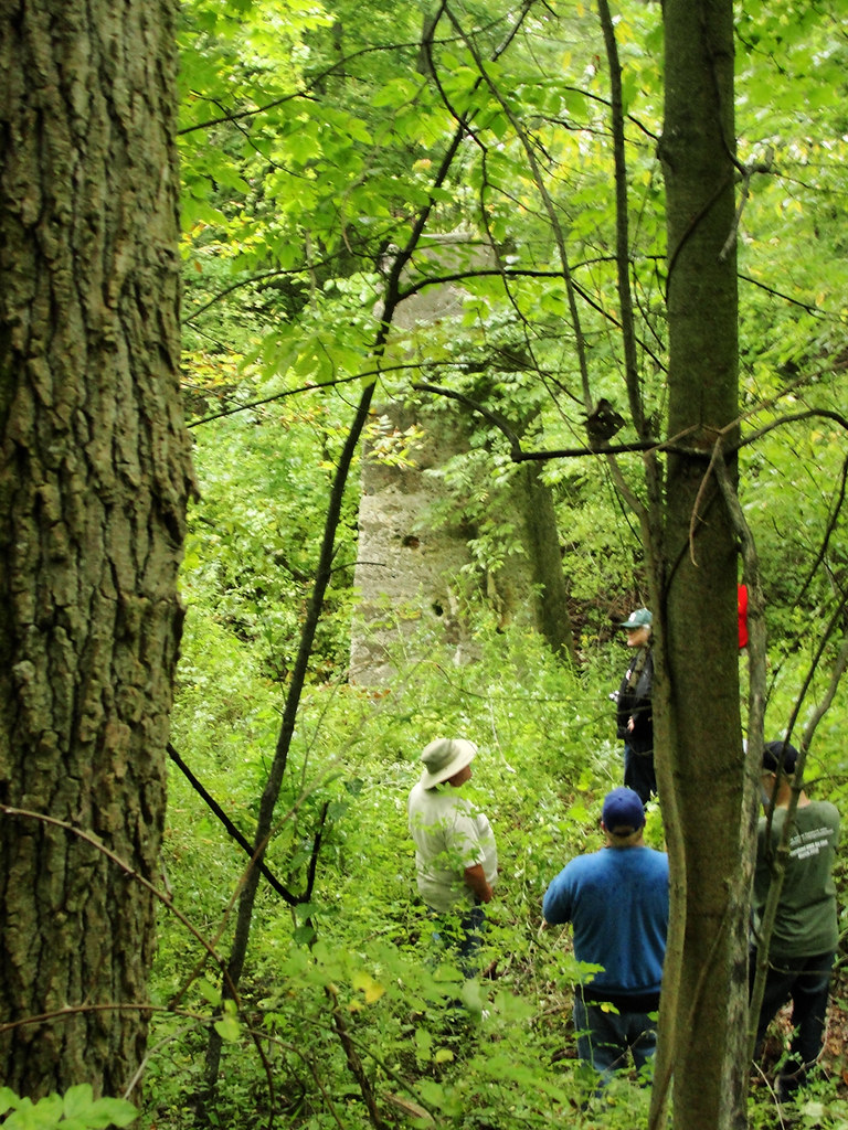
It's not much of a long distance trail, but there's quite an elevation change in the area, although it's also an area you really need to watch your step in. We had quite a group, and I recall several people had a hard time making it down the trail where I took the photo above. We wound up hiking out along the old Feick Road grade. There was also a large washout in the old grade, likely where the retention pond drained into the nearby river. I'd be really, really careful hiking along that grade. I went back and looked at the rest of my pictures from that trip and the vegetation was so thick on the edges of the grade that you might not see that washout until too late.
I also took a closer look at the satellite view on Google and I think these are the coordinates of the column:
Clyde Township, MI
43.064356, -82.583973
If you do head out there, good luck. I think you'll find it's mostly undisturbed aside from the toll of time and nature.
The area in question is part of the Port Huron State Game Area. I'd make sure to wear lots of orange, if you're heading into that area, wagnew0923. It's an interesting area to hike in, and has several abandoned logging(?) roads you can walk on as well.
Using Google's maps, I think this is near the location AARR mentioned.
Clyde Township, MI
43.064712, -82.586743
The tree coverage is pretty thick. We had to hike in from the parking lot at the end of Feick Road, but all I recall is that we had a local guide (who posts here occasionally) and we didn't take the Feick Road right of way leading southwest from the parking lot.
Clyde Township, MI
43.064485, -82.581387
For what it's worth, this is one of the artifacts we found in the woods:
It's not much of a long distance trail, but there's quite an elevation change in the area, although it's also an area you really need to watch your step in. We had quite a group, and I recall several people had a hard time making it down the trail where I took the photo above. We wound up hiking out along the old Feick Road grade. There was also a large washout in the old grade, likely where the retention pond drained into the nearby river. I'd be really, really careful hiking along that grade. I went back and looked at the rest of my pictures from that trip and the vegetation was so thick on the edges of the grade that you might not see that washout until too late.
I also took a closer look at the satellite view on Google and I think these are the coordinates of the column:
Clyde Township, MI
43.064356, -82.583973
If you do head out there, good luck. I think you'll find it's mostly undisturbed aside from the toll of time and nature.
~ Charles W.
-
wagnew0923
- Railroadfan...fan
- Posts: 416
- Joined: Sun Jun 10, 2012 10:37 am
Re: Help Hiking Advice Needed
I am planning on going in January so I will have less vegetation to deal with. This looks great. It is either this line or the line to Avoca.
-
GreatLakesRailfan
- Railroadfan...fan
- Posts: 4829
- Joined: Wed Aug 24, 2005 12:28 am
- Location: Marysville, Michigan
Re: Help Hiking Advice Needed
You may be able to hike the line between Avoca and Brown City. With the M19 crossing in Yale removed this fall, there won't be any pesky trains around to get in your way. IIRC, the tracks are active to about a mile east of Brown City, where DTE ownership begins. The rumor I've heard is that there's a bridge somewhere northwest of Yale that is too weak for railroad traffic without a rebuild.wagnew0923 wrote:I am planning on going in January so I will have less vegetation to deal with. This looks great. It is either this line or the line to Avoca.
~ Charles W.
-
James Sofonia

- Grand Traverse Dinner Train 1996
- Posts: 1701
- Joined: Mon Mar 10, 2014 7:56 pm
- Location: Traverse City, Michigan
Re: Help Hiking Advice Needed
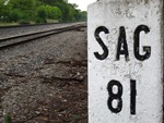
Might be this one 3 miles NW of Yale. Looks kinda sagging in the middle.GreatLakesRailfan wrote:wagnew0923 wrote:The rumor I've heard is that there's a bridge somewhere northwest of Yale that is too weak for railroad traffic without a rebuild.
- Attachments
-
-
Michael
- Railroadfan...fan
- Posts: 11023
- Joined: Sun Sep 12, 2010 2:52 pm
- Location: Plymouth, Michigan
Re: Help Hiking Advice Needed
BING birds eye view of that bridge
http://binged.it/1QiErGR
http://binged.it/1QiErGR
-
James Sofonia
- Grand Traverse Dinner Train 1996
- Posts: 1701
- Joined: Mon Mar 10, 2014 7:56 pm
- Location: Traverse City, Michigan
Re: Help Hiking Advice Needed
That is a nice picture of the bridge. I should work with Bing more often.
It looks like there is a waterfall or spillway in front of the bridge. I wonder what is going on there?
It looks like there is a waterfall or spillway in front of the bridge. I wonder what is going on there?
-
wagnew0923
- Railroadfan...fan
- Posts: 416
- Joined: Sun Jun 10, 2012 10:37 am
Re: Help Hiking Advice Needed
Does the power plant still get serviced
-
GreatLakesRailfan
- Railroadfan...fan
- Posts: 4829
- Joined: Wed Aug 24, 2005 12:28 am
- Location: Marysville, Michigan
Re: Help Hiking Advice Needed
Greenwood is a peaker plant, and burns natural gas. I suppose the gas company still services the plant, but the last known train east of Brown City ran in 1999. Condition of the tracks east of the wye to the power plant (there's another one to add to the list in the Michigan forum!) is much worse than up to that point.wagnew0923 wrote:Does the power plant still get serviced
~ Charles W.